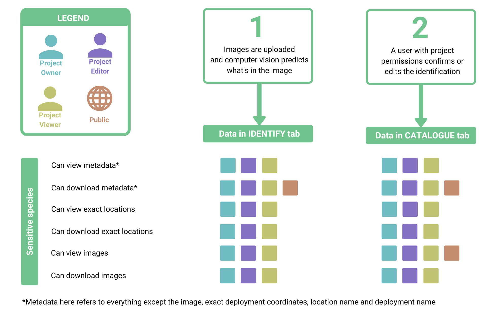
Sensitive Species
Wildlife Insights is committed to sharing data for conservation purposes. However, certain species may be at risk with the exposure of specific geographic location data. Wildlife Insights will restrict public access to the exact locations of sensitive species to protect these species. Images may be available publicly, but will only be associated with the project. Wildlife Insights and Wildlife Insights Core Partners may use sensitive species data to create derived products, but will never publicly expose the underlying location data.
SKIP AHEAD TO
How does Wildlife Insights define sensitive species?
How does Wildlife Insights define sensitive species?
The list of sensitive species is defined and managed by Wildlife Insights based on best practices and expert consultations. The Wildlife Insights sensitive species list includes:
- All terrestrial vertebrates (mammals, amphibians, reptiles, and birds) with IUCN Red List of Endangered Species categories CR, EN, and VU and whose main threats are associated with hunting and poaching;
- eBird’s sensitive species list, which was broadened to the species level, and regionally sensitive species were removed.
- Species of local concern that don’t meet the above definition, if requested by a project owner.
How does Wildlife Insights protect sensitive species locations?
Wildlife Insights will fuzz the exact coordinates of all deployments set at a location where a sensitive species is captured. The fuzzed coordinates will be provided in lieu of the exact coordinates in all public downloads.
If you are downloading public data, you can determine which deployments have fuzzed coordinates by referring to the column Fuzzed in the deployments.csv provided in your download package. If the value is True, the deployment's coordinates have been fuzzed. If the value is False, the coordinates provided are the exact coordinates provided to Wildlife Insights.
Who can access sensitive species information?
 Back to the guide