An Ecological Corridor for the Conservation and Management of the Jaguar in Colombia
Project background
WWF Colombia is working with the Corporation for the Sustainable Development of Northern and Eastern Amazon (Corporación para el Desarrollo Sostenible del Norte y el Oriente Amazonico, CDA), the Corporation for Research, Agricultural and Environmental Development (Corporación para la Investigación, Desarrollo Agropecuario y Ambiental, CINDAP), and the United Nations Development Programme (UNDP), in partnership with local communities, to support the "Prioritized Corridor for the Conservation and Management of the Jaguar (Panthera onca)" in Guaviare, Colombia.
This proposed wildlife corridor encompasses approximately 75,000 hectares and connects an Indigenous reservation (Nukak) with 3 protected areas (Chiribiquete, Macarena and Nukak). This region has been identified as an important corridor for jaguars and as part of a longer range corridor that extends from Mexico to Argentina. However livestock herding is the primary activity in this area, and jaguars frequently come into conflict with these animals.
WWF Colombia’s project aims to:
- Confirm the presence of jaguar in the corridor and assess the enabling conditions necessary for its persistence (habitat integrity and prey abundance)
- Reduce the frequency of human-jaguar conflict, by addressing the vulnerability of livestock systems
- Restore ecological connectivity for jaguars in the region
The project has received additional support from the Amazon Sustainable Landscapes Program (ASL), funded by the Global Environment Facility (GEF), and led by the World Bank. Within the ASL’s regional project, support was provided to projects in Colombia, Brazil and Peru to strengthen the capacity of governments and communities to analyze camera trap data. For this jaguar corridor in Guaviare, support allowed for camera trap data collected between 2021 and 2022 from 55 cameras. Data from the cameras was then processed and analyzed in Wildlife Insights and the specific tool designed for the ASL, validating the presence of the jaguar in the proposed corridor.
Breaking down barriers with Wildlife Insights
It is critical that communities in the project area have a stake in the data collection process and have equal access to the information collected. Before using Wildlife Insights, it was difficult to share camera trap images with our community partners. Wildlife Insights is an intuitive tool that makes it easy for our partners to view photos and manage all the information in one place. It greatly reduced the time spent processing images, particularly blank images, and provided information in a way that was easy to digest, analyze and share across teams and with members of the community. Additionally, ASL supported the development of an analytical tool for this project, which made it easy for anyone involved to explore and interpret the data collected.

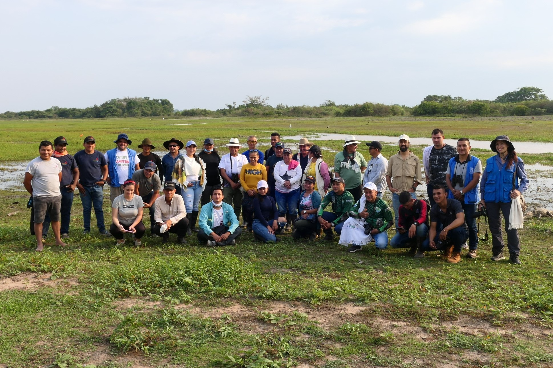
Members of the Jaguar Corridor community monitoring group
Using Wildlife Insights to empower communities and confirm the presence of jaguars in the corridor
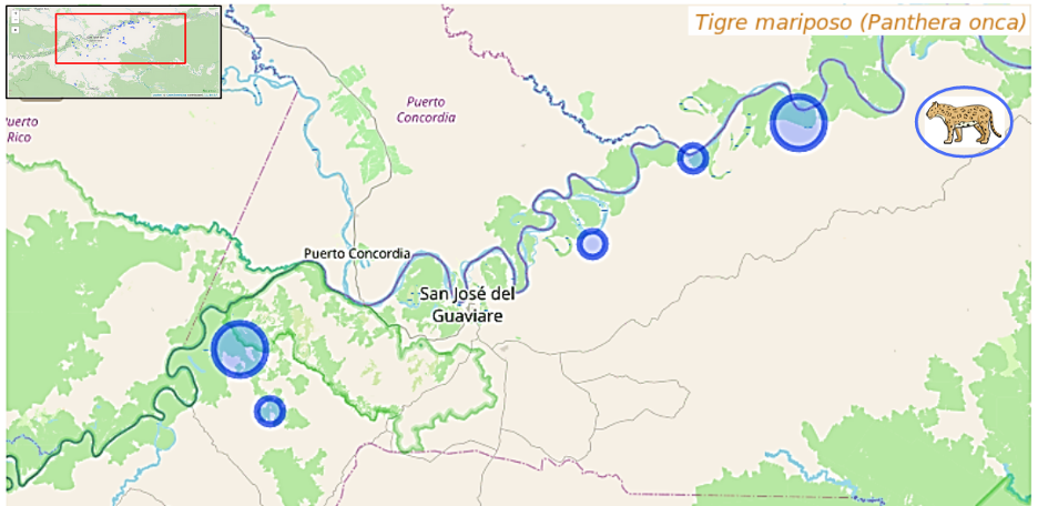
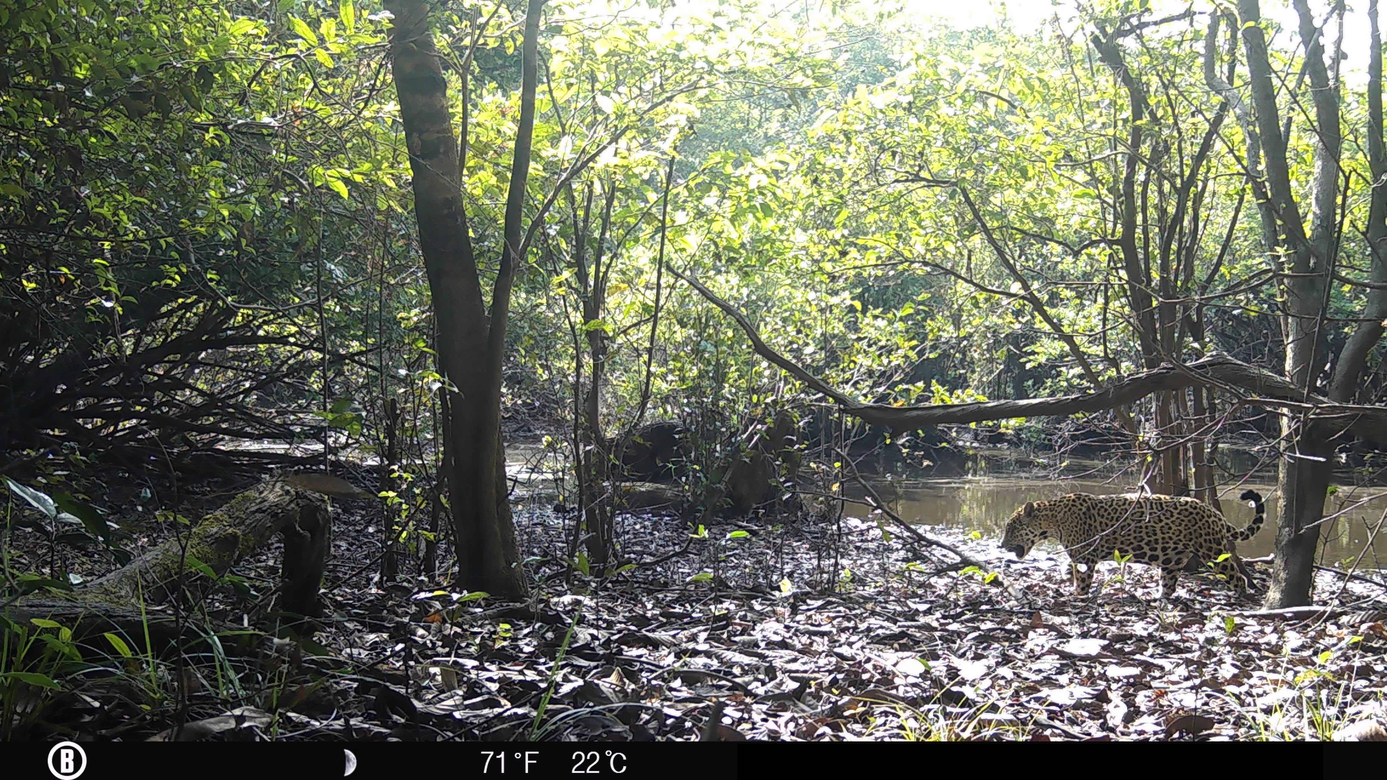
The results of our study, corroborated by the camera traps, confirmed a significant jaguar presence in the corridor, as well as diverse and abundant jaguar prey. Four other species of wild cats were also detected, as well as other endangered species, some of which had not been previously detected in the area. In addition to validating the proposed jaguar corridor, the results also sparked the beginning of a joint restoration strategy to improve ecosystem connectivity and address issues around human-jaguar co-existence.

Jaguar detections within the corridor
Wildlife Insights also empowered communities to collect and utilize biodiversity data in their own ways. Some residents have proposed using Wildlife Insights to support regional ecotourism activities. As a result of this initiative, community monitoring groups were established in the region and plan to lead future camera trapping efforts themselves.

All photos provided by WWF Colombia and Monitores Corredor del Jaguar under Creative Commons license CC-BY-NC
Share your story with the Wildlife Insights community!

